
1475: "Coriolis Effect Explained"
Interesting Things with JC #1475: "Coriolis Effect Explained" – A breeze feels simple enough, but its path hides an influence turning just beneath our feet. A subtle shift in motion reveals how the planet gently redirects the world above it.
Curriculum - Episode Anchor
Episode Title: Coriolis Effect Explained
Episode Number: 1475
Host: JC
Audience: Grades 9–12, college intro, homeschool, lifelong learners
Subject Area: Earth science, atmospheric science, physics, geography
Lesson Overview
By the end of this lesson, learners will be able to:
Define the Coriolis effect and its cause.
Compare Northern and Southern Hemisphere deflection patterns in air and water movement.
Analyze how Earth’s rotation influences wind belts, ocean gyres, and storm systems.
Explain real-world examples of Coriolis-driven motion, including hurricanes and wildfire smoke transport.
Key Vocabulary
Coriolis Effect (kor-ee-oh-liss) — The apparent deflection of moving objects caused by Earth’s rotation; for example, winds bending right in the Northern Hemisphere.
Hadley Cell (had-lee) — A large-scale atmospheric circulation loop near the equator; rising warm air feeds into the trade winds.
Ferrel Cell (fair-ull) — A mid-latitude circulation loop that contributes to prevailing westerly winds.
Gyre (jy-er) — A large system of rotating ocean currents; for instance, the North Atlantic gyre spinning clockwise.
Sidereal Day (sy-deer-ee-uhl) — The time Earth takes to rotate once relative to distant stars (just under 24 hours).
Narrative Core
Open: You can stand outside on a calm day and feel only a steady breeze, never sensing the enormous rotation beneath your feet.
Info: Earth rotates once every sidereal day, and because the equator travels faster than the poles, any air or water moving north–south carries its original eastward speed.
Details: This difference in rotational speed bends air and water: rightward in the Northern Hemisphere and leftward in the Southern Hemisphere. Large systems—wind belts, ocean gyres, and storms—all reveal this effect. Even drifting wildfire smoke can show measurable deflection.
Reflection: The Coriolis effect becomes intuitive once recognized: Earth’s steady spin quietly shapes global weather, ocean currents, and the behavior of vast storm systems.
Closing: These are interesting things, with JC.
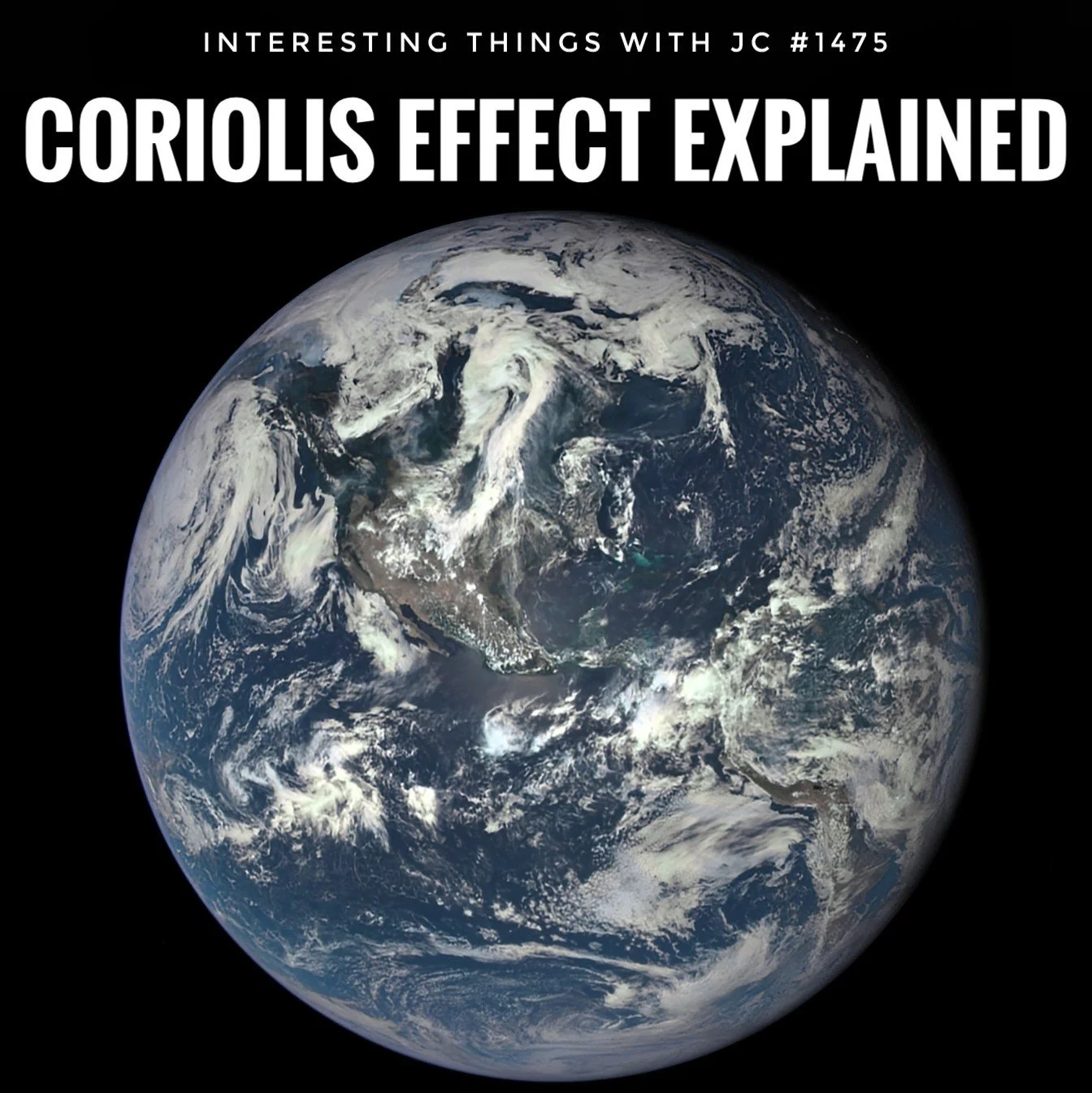
A full-disk view of Earth is shown against a black background, captured from space. North and Central America sit near the center of the image, with swirling white cloud bands stretching across the continents and oceans. The deep blue of the Pacific and Atlantic Oceans contrasts with the lighter cloud formations, and the curve of the planet is clearly visible along the lower edge. At the top of the image, bold white text reads “Interesting Things with JC #1475” and beneath it, in larger letters, “Coriolis Effect Explained.”
Transcript
On a calm day, you can stand outside, feel a steady breeze, and never notice that the ground under you is turning. But that steady rotation shapes most of the large patterns we see in the air and in the ocean.
Earth makes one sidereal turn in just under 24 hours, covering 24,901 miles, or 40,075 kilometers. The surface near the equator (ee-kway-ter) moves quicker than the surface closer to the poles. That change in speed is enough to shift the path of anything moving long distances.
When air or water moves north or south, it keeps the turning speed from the latitude it started from. Air moving north hangs on to a little more eastward speed and bends to the right. Air moving south carries a little less and bends left. In the Northern Hemisphere, motion gets pushed to the right. In the Southern Hemisphere, it pushes left. Gaspard Gustave de Coriolis (gas-par goo-stav duh ko-ree-oh-liss) worked out the math in 1835, and his numbers still guide modern forecasting.
You can see it in the global wind belts. Warm air rising near the equator feeds into the Hadley cell (had-lee) and angles into the trade winds. Farther north, the Ferrel cell (fair-ull) shapes the westerlies. The oceans follow the same pattern. The North Atlantic gyre, thousands of miles across, turns clockwise and drives the Gulf Stream up the American coastline before sending warmer water toward Europe.
Storms show the effect clearly. A hurricane that spans a few hundred miles has enough size and time for that sideways push to twist its inflow into a broad spiral: counterclockwise in the north and clockwise in the south. Near the equator, the effect weakens so much that strong tropical storms almost never form there, even when the water is warm enough.
You can also see it in long-range smoke movement. During heavy wildfire seasons in Australia (uh-strail-yuh), high-altitude smoke drifting through southern winds bends left sooner than early models predicted. That shift isn’t caused by heat or mountains. It’s the Coriolis effect acting on particles traveling hundreds of miles.
The Coriolis effect is simple once you see it: Earth turns at a steady rate, and anything moving over its surface has to adjust. That steady turn shapes winds, currents, and storms around the world every day.
These are interesting things, with JC.
Student Worksheet
Define the Coriolis effect using your own words based on the episode.
Why does the equator move faster than regions near the poles?
Explain why hurricanes rotate counterclockwise in the Northern Hemisphere and clockwise in the Southern Hemisphere.
How do global wind belts such as the Hadley and Ferrel cells demonstrate the Coriolis effect?
Describe how wildfire smoke in Australia provides evidence of the Coriolis effect.
Teacher Guide
Estimated Time
45–60 minutes
Pre-Teaching Vocabulary Strategy
• Use labeled diagrams of Earth’s rotation and latitude lines.
• Provide a globe and demonstrate relative speed differences at various latitudes.
• Have students predict how moving air might behave before listening to the episode.
Anticipated Misconceptions
• Students may think the Coriolis effect determines the rotation of small household objects like draining water—address scale dependency.
• Students may incorrectly assume the Coriolis effect is caused by wind, not Earth’s rotation.
• Students may think the effect pushes objects physically rather than altering reference frames.
Discussion Prompts
• How do differences in rotational speed at various latitudes influence climate patterns?
• Why do tropical storms rarely form at the equator?
• Where else in nature or technology might rotating reference frames matter?
Differentiation Strategies
• ESL: Provide illustrated vocabulary cards; allow verbal explanations with visuals.
• IEP: Break complex processes into stepwise diagrams; provide guided notes.
• Gifted: Challenge students to calculate approximate Coriolis deflection at different latitudes.
Extension Activities
• Map hurricane tracks and analyze hemispheric rotation patterns.
• Use a rotating turntable and moving objects to simulate Coriolis deflection.
• Investigate real satellite imagery of ocean gyres or global wind belts.
Cross-Curricular Connections
• Physics: Rotating reference frames and inertia.
• Geography: Climate zones, ocean circulation, wind belts.
• Mathematics: Angular velocity, vector direction changes.
Quiz
Q1. What causes the Coriolis effect?
A. Differences in air temperature
B. Earth’s rotation
C. Ocean salinity changes
D. Mountain ranges
Answer: B
Q2. In the Northern Hemisphere, moving air bends:
A. Left
B. Right
C. Upward
D. Downward
Answer: B
Q3. Which global circulation cell is closest to the equator?
A. Ferrel cell
B. Polar cell
C. Hadley cell
D. Arctic cell
Answer: C
Q4. Hurricanes rotate counterclockwise in the Northern Hemisphere because:
A. Ocean temperatures differ from the Southern Hemisphere
B. Wind speeds are weaker in the north
C. The Coriolis effect bends inflow to the right
D. They form only over land
Answer: C
Q5. Why do strong tropical storms rarely form at the equator?
A. No warm water exists there
B. Coriolis effect is too weak
C. Air cannot rise near the equator
D. Ocean currents cancel storms
Answer: B
Assessment
Explain how the Coriolis effect influences both atmospheric circulation and major ocean currents.
Describe a real-world example from the episode and analyze how the Coriolis effect alters the object or system’s movement.
3–2–1 Rubric
• 3 = Accurate, complete, and demonstrates clear conceptual understanding with supporting details.
• 2 = Partially accurate or missing key details; understanding is developing but incomplete.
• 1 = Inaccurate, vague, or shows limited understanding.
Standards Alignment
NGSS (U.S.)
• HS-ESS2-5 — Examines how Earth’s rotation influences atmospheric circulation patterns such as wind belts.
• HS-ESS2-6 — Models how variations in Earth systems (like rotation and latitude) create climate patterns.
• HS-PS2-1 — Connects motion of objects to forces and reference frames.
Common Core (ELA/Literacy)
• RST.11-12.2 — Determine central ideas of scientific texts, such as Coriolis-driven circulation.
• RST.9-10.3 — Follow multistep processes, including atmospheric circulation explanations.
C3 Framework (Social Studies/Geography)
• D2.Geo.2.9-12 — Use geographic representations to explain environmental processes like wind and ocean currents.
• D2.Geo.5.9-12 — Explain how Earth’s physical processes influence human and natural systems.
ISTE Standards (Technology)
• 3.1 Knowledge Constructor — Students gather and evaluate scientific data, such as hurricane paths.
• 4.1 Innovative Designer — Students model environmental systems influenced by rotation.
International Equivalents
UK National Curriculum (Geography Key Stage 5)
• Atmospheric circulation and global climate systems align with Earth rotation and deflection processes.
Cambridge IGCSE Geography (0460)
• Section: Weather, climate, and ecosystems — explains global atmospheric circulation patterns driven by rotation.
IB DP Geography (SL/HL)
• Atmospheric hazards and global climate systems include Coriolis-driven storm dynamics.
Show Notes
This episode of Interesting Things with JC unpacks the Coriolis effect—an essential atmospheric and oceanic phenomenon resulting from Earth’s steady rotation. JC explains why the equator moves faster than the poles, how this speed difference bends winds and currents, and why large-scale systems such as hurricanes, trade winds, ocean gyres, and even drifting wildfire smoke all follow predictable curved paths. This topic is valuable in classrooms because it links physics, Earth science, and geography, helping learners understand weather patterns, climate systems, storm development, and global transportation of air and water. Understanding the Coriolis effect builds scientific literacy and provides a foundation for more advanced meteorology and environmental science.
References
NOAA National Weather Service - Coriolis Effect and Global Wind Patterns https://www.weather.gov/jetstream/coriolis
NASA Earth Observatory - Global Circulation Patterns https://earthobservatory.nasa.gov/features/EnergyBalance/page5.php
National Hurricane Center (NOAA) - How Hurricanes Form https://www.nhc.noaa.gov/prepare/hazards.php
Bureau of Meteorology (Australia) - Global Circulation and Coriolis Effect in the Southern Hemisphere
http://www.bom.gov.au/watl/about-weather-and-climate/global-circulation.shtmlNOAA National Ocean Service - Ocean Gyres and Global Circulation https://oceanservice.noaa.gov/education/tutorial_currents/04gyres.html